Search results
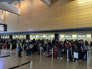
News about cyberattack, Port of Seattle, SEA Airport
News about Orlando International Airport, increased fee, North Terminal Complex
Also in the news
An airport is an aerodrome with extended facilities, mostly for commercial air transport. [ 1][ 2] Airports usually consist of a landing area, which comprises an aerially accessible open space including at least one operationally active surface such as a runway for a plane to take off and to land [ 3] or a helipad, [ 4] and often includes adjace...
At the Airport. Eat, Shop, Relax. Dining and Shopping. Need Special Assistance? Accessibility. Let's get you to the right terminal. Terminal Map. Select Terminal. Terminal 1 Terminal 2. 4300 Glumack Drive St. Paul, MN 55111. 612-726-5555.
Jul 30, 2024 · Just south of Minneapolis and St. Paul in Lakeville, Airlake Airport mostly serves recreational fliers but is also ideally suited for business aviation. Several improvements are planned for Airlake to better meet the needs of business aircraft in this growing Twin Cities suburb.
Discover more placesNear Columbus, OH
People also search for
Refine results for Airports
Aug 8, 2024 · Complete aeronautical information about Airlake Airport (Minneapolis, MN, USA), including location, runways, taxiways, navaids, radio frequencies, FBO information, fuel prices, sunrise and sunset times, aerial photo, airport diagram.
Owned by the Metropolitan Airports Commission, It is approximately 20 miles (32 km) south of both downtown Minneapolis and downtown St. Paul [ 2] [ 1] The airport is located near the Twin Cities suburbs of Lakeville and Farmington .
Nearest major airport to Lakeville, Minnesota: Search for direct flights from your hometown and find hotels near Lakeville, MN, or scroll down for more international airports or domestic airports. You can also browse local airports if you're a pilot.
The closest airport to Lakeville is Minneapolis–Saint Paul International Airport (MSP). Distance from Minneapolis–Saint Paul International Airport to Lakeville is 16.1 miles / 25.9 kilometers.
Located 22 miles S of Minneapolis, Minnesota on 425 acres of land. View all Airports in Minnesota. Surveyed Elevation is 960 feet MSL. Operations Data. Airport Use: Open to the public. Activation Date: December 1966. Status:
There are two terminals at MSP: Terminal 1 and Terminal 2. The terminals are accessed off separate roadways, so it is important to know which terminal you will fly in or out of. Check the airlines by terminal page to find out which terminal you’ll need.
Directions to Terminal 2. Click on link for driving directions to: Terminal 2 via Google Maps™. From Minneapolis. Take I-35W south to I-494 east. Take I-494 east to the 34th Avenue exit. Exit 34th Avenue and turn left (north) at the traffic light. Follow the signs to Terminal 2.
