Search results
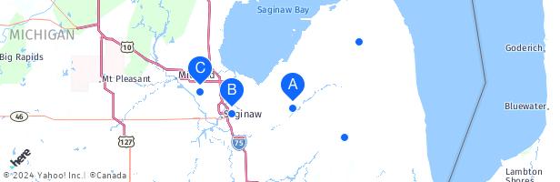
Discover more placesNear Caro, MI
People also search for
Refine results for Airports
The airport is located 3 miles Southwest of Caro Michigan and has a courtesy car available upon request. The airport serves all types of aircraft, experimental and helicopters through corportate jets (max runway of 4,302 feet).
- About Us
TUSCOLA AREA AIRPORT AUTHORITY 1750 SPEIRS DR. CARO, MI...
- Services
Services - TUSCOLA AREA AIRPORT (KCFS) | HEART OF THE THUMB
- Nav Aids
Nav Aids - TUSCOLA AREA AIRPORT (KCFS) | HEART OF THE THUMB
- Weather
Weather - TUSCOLA AREA AIRPORT (KCFS) | HEART OF THE THUMB
- Photos
Photos - TUSCOLA AREA AIRPORT (KCFS) | HEART OF THE THUMB
- Issues and Concerns
If there is an issue or concern you would like the airport...
- Hangar Rental
Contact Airport Assistant Manager for information Lynn...
- Vor/Dme
Vor/Dme - TUSCOLA AREA AIRPORT (KCFS) | HEART OF THE THUMB
- About Us
May 16, 2024 · Complete aeronautical information about Tuscola Area Airport (Caro, MI, USA), including location, runways, taxiways, navaids, radio frequencies, FBO information, fuel prices, sunrise and sunset times, aerial photo, airport diagram.
Tuscola Area Airport (IATA: TZC, ICAO: KCFS, FAA LID: CFS, formerly 78D) is a public use airport located three nautical miles (6 km) southwest of the central business district of Caro, a city in Tuscola County, Michigan, United States. It is owned by the Tuscola Area Airport Authority.
May 23, 2024 · Hangars and tiedowns available. Tuscola Area Airport (KCFS) located in Caro, Michigan, United States. Airport information including flight arrivals, flight departures, instrument approach procedures, weather, location, runways, diagrams, sectional charts, navaids, radio communication frequencies, FBO and fuel prices, hotels, car rentals ...
- 704.3 feet MSL (215 m MSL)
- 083-26-43.6080W (-83.445447)
- 43-27-31.8990N (43.458861)
- 7.5 W (as of April 2024 from WMM2020 model)
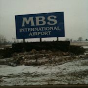
The nearest major airport is MBS International Airport (MBS / KMBS). This airport has domestic flights from Freeland, Michigan and is 43 miles from the center of Caro, MI. Another major airport is Bishop International Airport (FNT / KFNT), which has domestic flights from Flint, Michigan and is 56 miles from Caro, MI.
Airport Identifier: CFS: Airport Status: Operational: Longitude/Latitude: 083-26-43.6046W/43-27-31.9030N-83.445446/43.458862 (Estimated) Elevation: 704 ft / 214.58 m (Surveyed) Land: 260 acres: From nearest city: 3 nautical miles SW of Caro, MI: Location: Tuscola County, MI: Magnetic Variation: 06W (1985)
Tuscola Area Airport (ICAO: KCFS , FAA LID: CFS, formerly 78D) is a public use airport located three nautical miles (6 km) southwest of the central business district of Caro, a city in Tuscola County, Michigan, United States. It is owned by the Tuscola Area Airport Authority.