Search results
Interactive real-time wildfire map for the United States, including California, Oregon, Washington, Idaho, Arizona, and others. See current wildfires and wildfire perimeters near you using the Fire, Weather & Avalanche Wildfire Map.
The AirNow Fire and Smoke Map provides information that you can use to help protect your health from wildfire smoke. Use this map to see: Current particle pollution air quality information for your location; Fire locations and smoke plumes; Smoke Forecast Outlooks, where available; and, Recommendations for actions to take to protect yourself ...
Current and historical fire perimeter maps can be found on Wildland Fire Open Data site. Real-time wildland fire situational information including fire perimeters, weather, and fire detections can be found on the Enterprise GeoSpatial Portal (EGP) map.
4 days ago · These wildfires have burned 2,060,058 acres. About 18,900 wildland firefighters and support personnel are assigned to wildfires, including 21 complex and 2 Type 1 incident management teams, 450 crews, 760 engines, 107 helicopters, and four Modular Airborne Fire Fighting Systems, or MAFFS.
Aug 22, 2022 · Daily Summary. Updated August 26. As of Monday, there are 27 large or notable new fires burning in the United States, fueled by hot, dry and windy conditions in many areas. Several outbreaks in...
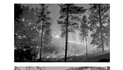
Wildfire. Wildfire burning in the Kaibab National Forest, Arizona, United States, in 2020. The Mangum Fire burned more than 70,000 acres (280 km 2) of forest. A wildfire, forest fire, or a bushfire is an unplanned, uncontrolled and unpredictable fire in an area of combustible vegetation. [ 1][ 2] Depending on the type of vegetation present, a ...
Jul 27, 2022 · See where wildfires are in the United States with this map that is updated daily. Track wildfires blazing in California, Alaska and other states as temperatures rise.
Get real-time updates on wildfires, smoke, and lightning strikes across the United States with Map of Fire. Monitor the spread and intensity of wildfires, track smoke dispersion, and stay alert to lightning activity.
Oct 19, 2023 · A wildfire is an uncontrolled fire that burns in the wildland vegetation, often in rural areas. Wildfires can burn in forests, grasslands, savannas, and other ecosystems, and have been doing so for hundreds of millions of years.
Large fires on InciWeb have information about the wildfire, news, and announcements, contact information and hours of operation, maps, photographs, and videos. This site is updated regularly and is the best place to find current fire information for ongoing wildfires.


