Search results
The official Virginia Creeper Trail map is printed by the Virginia Creeper Trail Club. One side details the Abingdon to Damascus section and the reverse side maps out the trail corridor from Damascus to Whitetop. All 34 mile markers are indicated along with each of the 47 trestle bridges.
Virginia Creeper Trail Maps. Explore the scenic Virginia Creeper Trail with our detailed maps. Plan your bike ride and discover breathtaking views along this picturesque trail.
Downloadable PDF with map and mileage chart. This interactive map of the Virginia Creeper Trail shows you town locations, distances, and services along the trail.
- www.alltrails.com
- › United States
- › Virginia
Get to know this 33.8-mile point-to-point trail near Whitetop, Virginia. Generally considered a moderately challenging route, it takes an average of 11 h 38 min to complete. This is a popular trail for camping, fishing, and hiking, but you can still enjoy some solitude during quieter times of day.
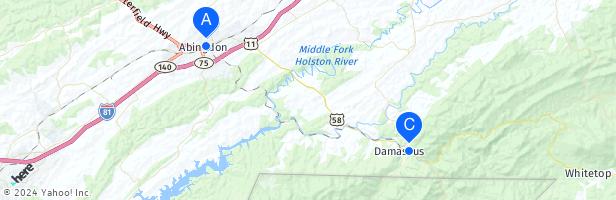
The Virginia Creeper Trail is a 35-mile (56 km) multi-purpose rail trail. Located in southwestern Virginia, the trail runs from Abingdon to Whitetop, Virginia, near Mount Rogers National Recreation Area and the North Carolina state line.
The Virginia Creeper Trail is a nationally acclaimed Rails-to-Trails project that draws visitors from all across the country.
Rent a Bike. Spend a day in Damsacus on the Virginia Creeper. Virginia Creeper Trail Maps and visitor information.
Virginia Creeper Trail. Virginia Creeper Trail. Sign in. Open full screen to view more. This map was created by a user. Learn how to create your own. ...
- www.alltrails.com
- › United States
- › Virginia
- › Abingdon
Check out this 16.1-mile point-to-point trail near Abingdon, Virginia. Generally considered a moderately challenging route, it takes an average of 5 h 23 min to complete. This is a popular trail for hiking, mountain biking, and road biking, but you can still enjoy some solitude during quieter times of day.
Map the trail with mile points for your trip. Build a list of services and mileage distances along your planned route. Calculate ETA and travel times for towns along your route. Check out what's available along the Virginia Creeper Trail. See distances between towns. See how much the trail ascends and descends.