Search results
4 days ago · See a county map of Florida on Google Maps with this free, interactive map tool. This Florida county map shows county borders and also has options to show county name labels, overlay city limits and townships and more.
- This Florida county lines map tool shows Florida county lines on Google Maps. You can also show county name labels on the map by checking the box i...
- You might need to know the Florida county for an address to: - determine applicable laws or regulations based on county jurisdiction - determine wh...
- This Florida County Boundary Lines map tool shows Florida county lines on Google Maps. Other tools on this website also show city limits, townships...
- To find the Florida county for an address, type the address in the 'Search places' box above this interactive Florida county finder map. the Florid...
- To find your Florida county using your address, type your address into the 'Search places' box above this map.
May 16, 2024 · Map of Florida: Click to see large Description: This map shows states boundaries, the state capital, counties, county seats, cities, towns, islands, lakes, national parks and main attractions in Florida.
Jan 23, 2024 · This map shows cities, towns, counties, interstate highways, U.S. highways, state highways, national parks, national forests, state parks, ports, airports, Amtrak stations, welcome centers, national monuments, scenic trails, rest areas and points of interest in Florida.
People also ask
How many counties are in Florida?
How do I find a county in Florida?
Which county in Florida has the most population?
Where is Miami-Dade County Florida located?
- Florida Counties Map
- Interactive Map of Florida Counties
- Five Largest Florida Counties by Population
- Five Smallest Florida Counties by Population
- Notable Florida Counties
- More About Florida Counties: FAQs
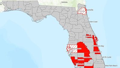
Below is a map of the 67 counties of Florida(you can click on the map to enlarge it and to see the major city in each county).
Click on any of the counties on the map to see its population, economic data, time zone, and zip code (the data will appear below the map). Data is sourced from the US Census 2021.
Miami-Dade County
Located at the southeastern tip of Florida, Miami-Dade County is the most populous county in Florida and is full of cultural, economic, and environmental significance. With a population that exceeds 2.7 million, Miami-Dade is demographically diverse and includes cultures influenced by Hispanic and Caribbean heritages. Miami, the county seat and one of the nation’s most vibrant cities, is globally recognized for its iconic skyline, bustling nightlife, historic neighborhoods like Little Havana,...
Broward County
Positioned directly north of Miami-Dade lies Broward County. With Fort Lauderdale as its county seat, Broward is Florida’s second-most populous county, providing a home to over 1.9 million residents. It is one of the most ethnically diverse counties in the United States. Known as the “Venice of America” for its 165 miles (265.5 km) of inland waterways, Fort Lauderdale embodies the coastal elegance that many associate with Florida’s eastern seaboard. Broward’s coastline, spanning 23 miles, off...
Palm Beach County
To the north of Broward County lies the expansive Palm Beach County, the largest county in Florida by land area and third-largest by population. With a rich tapestry of luxury resorts, cultural venues, and natural sanctuaries, it has long been a haven for America’s elite, including several U.S. presidentswho have favored its shores as a winter retreat. The city of West Palm Beach, the county seat, reflects a sophisticated blend of historic architecture, upscale shops, and a thriving arts scen...
Liberty County
Tucked away in Florida’s Panhandle is Liberty County, the least populous county in the state. The tranquil, rural landscapes of this county contrast with the state’s more urbanized centers and bustling tourist hubs. Its county seat, Bristol, represents the county’s laid-back, close-knit community feel. One of the most notable aspects of Liberty County is its unspoiled natural beauty. The Apalachicola National Forest covers roughly half of the county, offering a verdant retreat of pine trees,...
Lafayette County
Lafayette County, located in Florida’s Big Bend region, is the second-least populated county in the state. Along with Liberty County, it is one of the state’s dry counties, meaning the sale of alcohol is restricted. The county was created in 1856 and was named after the Marquis de Lafayette, a French general who fought in the American Revolutionary War. Its county seat, Mayo, gained media attention in 2018 when it temporarily changed its name to Miracle Whipas part of an advertising campaign...
Glades County
Nestled in the southwestern part of Florida is Glades County, a scenic area that displays some of the state’s natural beauty. The Caloosahatchee River to its south is just one of the waterways that have historically played a significant role in its development. Moore Haven, the county seat, stands on the river’s banks and often serves as a midpoint for boaters traversing from the Atlantic Ocean to the Gulf of Mexico. Beyond its waterways, Glades County offers an abundance of wildlife, notably...
Duval County
Encompassing the northeastern coast of Florida, Duval County is notable for its urban development, naval strength, and rich history. Its crown jewel, Jacksonville, is not just the state’s most populous city, it’s also the largest city by land area in the contiguous United States. Jacksonville’s vast urban expanse is punctuated by the winding St. Johns River, which has historically shaped Jacksonville’s development and provided a vital artery for trade and transportation. Also a significant po...
Leon County
Leon County is situated in the Florida Panhandle and is one of the state’s most notable counties because it houses the capital of Florida, Tallahassee. This makes it the central hub for Florida’s legislative and governmental activities. In addition to politics, Leon County is known for its contributions to learning and academia. It hosts two major institutions: Florida State University and Florida A&M University. These universities not only attract students from across the nation but also sig...
Monroe County
Stretching into the azure waters of the Gulf of Mexico and the Atlantic Ocean, Monroe County contains the beautiful islands known collectively as the Florida Keys. The county’s mainland makes up part of the Everglades and is sparsely populated. The county reaches the southernmost point of the continental U.S., with Key West, a vibrant city that serves as a magnet for artists, writers, and those seeking a laid-back island lifestyle. It hosts the annual Key West Songwriters Festivaleach May. Th...
Neighboring States’ County Maps: 1. Alabama Counties Map 2. Georgia Counties Map Also see: Florida map with cities
May 16, 2024 · Florida County Map. Click to see large. Description: This map shows counties of Florida. Size: 1300x1400px / 367 Kb. Author: Ontheworldmap.com. Previous version of the map.
CountySeatPopulation (2023) [1]Area [2]Alachua CountyGainesville285,994874 sq mi (2,264 sq km)Baker CountyMacclenny28,368585 sq mi (1,515 sq km)Bay CountyPanama City190,769764 sq mi (1,979 sq km)Bradford CountyStarke27,858293 sq mi (759 sq km)There are 67 counties in the U.S. state of Florida, which became a territory of the U.S. in 1821 with two counties complementing the provincial divisions retained as a Spanish territory, Escambia to the west and St. Johns to the east. The two counties were divided by the Suwannee River.
Florida Counties. The state of Florida is made up of 67 counties, each of which has its own government, school district, and county seat. The interactive map below shows the borders of each of these counties, and displays the names of individual counties when hovering over them with the mouse.


