Search results
News about California, fire hydrant thefts, heat wave
Also in the news
This map is an independent community effort developed to provide a general awareness of wildfire activity. UCANR is sharing this map solely as a reference, and is not responsible for the content or interpretation of the map . If you are near a fire or feel that you are at risk, please contact your local authorities for information and updates.
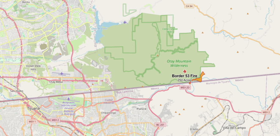
Map of active wildfires burning across California. Explore wildfire history and when fire season starts in California.
May 31, 2019 · Latest Cal Fire updates on active fires in California. Map shows acres burned and containment of wildfires throughout Northern California.
Aug 22, 2022 · The map includes active and recent fires reported by the Wildland Fire Interagency Geospatial Services Group. The locations of the fires on the map are approximate, derived from data...
Interactive real-time wildfire and forest fire map for California. See current wildfires and wildfire perimeters in California using the Fire, Weather & Avalanche Wildfire Map.
If you would like to obtain information about a CAL FIRE fire burning in your area that is not included on this web site, please contact the CAL FIRE Unit that services your county. Ongoing emergency responses in California, including all 10+ acre wildfires.
This map provides a number of layers from external fire agencies and organizations that provide consistently updated map layers regarding the location and status of active wildfires managed by CalFire as well as federal agencies.
California wildfires map. About this map. This map contains three different types of data: Fire origins mark the fire fighter's best guess of where the fire started. The data is provided by...
Aug 20, 2020 · The S.C.U. fire had destroyed 28 structures and injured two civilians and three emergency workers by Friday. It began as about 20 separate fires, all most likely ignited by lightning, that have...
Sep 20, 2023 · The live map below shows all the major wildfires burning through California, based on data from the federal Wildland Fire Interagency Geospatial Service. Click on the name of a fire listed in...


