Search results
News about National Hurricane Center, Atlantic Ocean, tropical disturbances
News about AccuWeather, Atlantic hurricane season, hurricane forecast
Also in the news
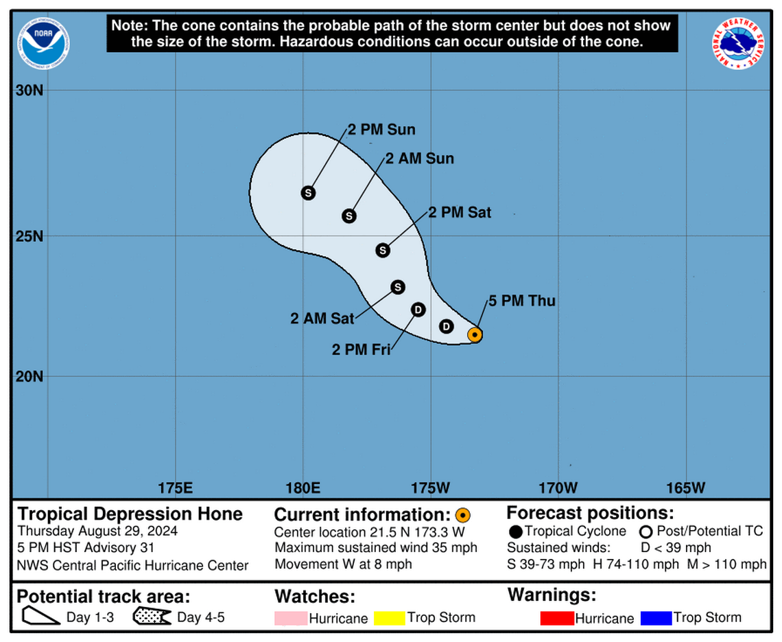
1 day ago · EXPECTED TO DISSIPATE NEAR KAUAI OVER THE WEEKEND... 11:00 PM HST Wed Aug 28. Location: 19.5°N 149.5°W. Moving: W at 14 mph. Min pressure: 1007 mb. Max sustained: 40 mph. Public. Advisory. #45.
Keep up with the latest hurricane watches and warnings with AccuWeather's Hurricane Center. Hurricane tracking maps, current sea temperatures, and more.
1 day ago · Top News of the Day... view past news. Last update Wed, 28 Aug 2024 16:05:50 UTC. NHC issuing advisories for the Eastern Pacific on TS Hector. CPHC issuing advisories for the Central Pacific on TS Hone and TS Gilma. Marine warnings are in effect for the Eastern Pacific.
2 days ago · Tropical Storm Hone. Satellite | Buoys | Grids | Storm Archive. ...HONE WEAKENS SOME MORE STILL HEADING WEST-NORTHWEST TOWARD THE THE DATE LINE... 5:00 AM HST Thu Aug 29. Location: 21.0°N 171.9°W. Moving: WNW at 9 mph. Min pressure: 1006 mb. Max sustained: 40 mph. Public.
The live hurricane tracker allows users to see the paths of previous hurricanes on this season’s hurricane map, as well as interact with the current hurricane tracker satellite imagery while accessing National Hurricane Center data and information.
Interactive world weather map. Track hurricanes, cyclones, storms. View LIVE satellite images, rain radar, forecast maps of wind, temperature for your location.
1 day ago · The busiest time of the Atlantic hurricane season runs from mid-August through mid-October, with the peak arriving Sept. 10.
