Search results
Discover more placesNear Washington, DC
Refine results for Public Transportation
People also ask
What is a DC metro map?
How many metro stations are in Washington DC?
How many DC metro lines are there?
How many metro lines are there?
NW, Washington, DC Red Line: College Park-U of Md College Park, MD Green Line: Columbia Heights NW, Washington, DC Green Line: Congress Heights SE, Washington, DC Green Line: Court House Arlington, VA Orange Line Silver Line: Crystal City Arlington, VA Blue Line Yellow Line: D Top: Deanwood NE, Washington, DC Orange Line: Downtown Largo Largo ...
- Silver Line
NW, Washington, DC Orange Line Silver Line Blue Line: Metro...
- Red Line
Search for transportation near you. Nearby Stations. ......
- Ronald Reagan Washington National Airport
Platforms at this station. There are 2 platforms at this...
- Franconia-Springfield
Franconia-Springfield - Stations | WMATA
- Virginia Square-GMU
Virginia Square-GMU - Stations | WMATA
- L'Enfant Plaza
On May 31, 2024, Metro will continue a major capital project...
- Woodley Park-Zoo/Adams Morgan
Woodley Park-Zoo/Adams Morgan - Stations | WMATA
- Pentagon
Washington Metropolitan Area Transit Authority Open Mobile...
- Silver Line
- Finding The Metro Station
- What's The Fare?
- Waiting For The Train
- Boarding The Train
- Rail Station Schedules/Hours
- SmarTrip® Card
If you're driving, look for the large Metro signs to direct you to stations. Look for tall brown columns with a large "M" identifying the station entrances. Colored stripes around the column show which lines serve the station. 1. View the Metrorail System Map. 2. Get detailed information about a particular Metro station.
To determine the fare between two stations, visit your starting station's page and use the Metrorail Fares fare finder in the middle of the page. For fares on trips that involve trains and buses, use ourTrip Planner. SmarTrip® card users get the lowest fares. See the SmarTrip® box on the right to learn more.
Read station signs to learn which train platform to use for your destination. Stand behind the bumpy tiles along the platform's edge. Watch for flashing lights along the platform's edge, which signal a train's arrival. Station signs will also alert you to a train's arrival. NEW |Train prediction improvements
Check the destination of the train, which is posted above the side windows. Stand clear of the train car doors and let riders get off before you board. Step over the small gap between the platform and the train. Listen for the chimes that signal the car doors are closing. If the train is full, step back and wait for the next train. Unlike elevator ...
First and last trains vary per station. Please use our Trip Planner andview station specific information. Each station will open 10 minutes before the first train arrives.Click here to get station specific information. General Rail Hours of Operation (NotStation Specific) 1. Monday through Thursday, 5:00 a.m. until 12:00 a.m. 2. Friday, 5:00 a.m. u...
The SmarTrip® card is a permanent, rechargeable farecard that is safe and easy to use.Put a SmarTip in your Apple or Google Wallet,Buy SmarTrip® cards online, at any Metrorail station, or at manyconvenient locations.
Metro news and service information for the Washington, DC, Maryland, and Virginia region.
DC’s Metro is one of the busiest public transportation systems in the country. Find out everything you need to know, get a Metro map, check operating hours, ride fares and more.
The DC Metro Map is a key tool for anybody living in or visiting the Washington DC area. Metro can be one of the most efficient ways to travel around the city, and understanding the system map can make travel easy. There are six metro lines: the Red Line, Blue Line, Orange Line, Silver Line, Yellow Line, and the Green Line.
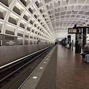
Rail. Metro. Photo by Mr/Smith (CC BY 2.0) Washington DC's Metro system is a great way to get to hundreds of popular locations and attractions in and around Washington DC. Metro's six lines and 91 stations are located in Washington DC and neighboring Virginia and Maryland.
Red Line. The Red Line provides service between Shady Grove Station and GlenMontStation, both in Montgomery County, MD, via downtown Washington DC. Popular destinations include Union Station (Washington DC's rail transportation hub), the National Zoo, the Verizon Center, and Dupont Circle. Blue Line.