Search results
Southern California Earthquake Data Center at Caltech. Recent Earthquakes in California and Nevada. Click on an earthquake on the above map for a zoomed-in view. Map Information. How do earthquakes get on these maps? Search Earthquakes Near You ( Relative2Me ). Map Frequently Asked Questions (FAQ)
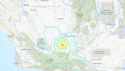
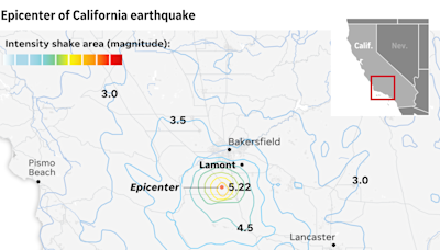
10 hours ago · A 5.2-magnitude earthquake struck near Lamont, California, on Tuesday night and rumbled through a broad stretch of Southern California, including Los Angeles. The US Geological Survey reported the ...
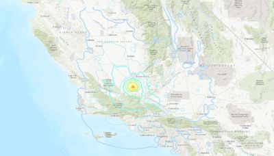
11 hours ago · Magnitude 5.2 earthquakes shakes Southern California after striking near Bakersfield 18:01 A preliminary 5.2- magnitude earthquake struck near Bakersfield and shook all the way to Los Angeles County.
12 hours ago · Updated 10:19 PM PDT, August 6, 2024. LOS ANGELES (AP) — An earthquake northwest of Los Angeles shook a large swath of Southern California on Tuesday night, but there were no immediate reports of damage. The U.S. Geological Survey said the 5.2 magnitude temblor stuck at 9:09 p.m. and was centered near Mettler, an unincorporated area in Kern ...
11 hours ago · 1:05. LOS ANGELES — A magnitude 5.3 earthquake rocked the San Joaquin Valley late Tuesday, the U.S. Geological Service said, jangling nerves as Southern Californians prepared for bedtime. The ...
Recent Earthquakes in the Southern California Region . Use the map below to explore recent earthquake activity. This map shows the earthquake feed from the USGS for all earthquakes in the last 7 days with the network codes of CI, NC, or NN, or between the latitude coordinates 32 and 42 and the longitude coordinates -126 and -114. The reporting ...
6 days ago · Recent Earthquakes in California and Nevada. Los Angeles Special Map. Click on an earthquake on the above map for more information. Update time = Thu Aug 1 16:00:04 2024. Here are the earthquakes appearing on this map, most recent at top ...


