Search results
Discover more placesNear California
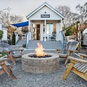
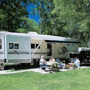
Refine results for Camping
Related businesses
A general Plan for Fort Ord Dunes State Park was adopted in 2004 and provides for the development of the new campground and beach access facilities and identifies the area immediately adjacent to the bunkers as the location for the campground. The project site lies largely outside the Highway 1 view shed and consists of approximately 130 acres ...
- OHP
The California Office of Historic Preservation (OHP)...
- Dbw
The ABCs of California Boating includes California boating...
- Commissions
California Boating and Waterways Commission. The Boating and...
- Director
Armando Quintero was named director of the California...
- Accessibility
The California Department of Parks and Recreation (DPR) is...
- Conditions of Use
California State Parks attempts to maintain the highest...
- Public Notices
CEQA - the California Environmental Quality Act, is a...
- OHP
- Monterey District's Newest California State Park
- Learn About Fort Ord Dunes State Park with Your Mobile Phone
- Dogs at Fort Ord Dunes State Park
Opened to the public in 2009, Fort Ord Dunes State Park provides nearly 1,000 acres dedicated to public land, and 4 miles of ocean beach with beautiful views of the Monterey Bay National Marine Sanctuary. Fort Ord's dunes and beaches are home to many endangered species. Please help us preserve these senstitive habitats by staying on designated trai...
At the main parking area visitors can view eight educational panels to learn more about the former Fort Ord US Army Base, as well as educational information about the natural history of the park. You can also use your mobile phone to learn more about the history of Fort Ord and its cultural and natural features via the mobile phone audio tour. The ...
In order to protect park resources, public access is limited to designated roads and trails which are open to bicyclists, hikers, and dogs on leash. Dogs are allowed on the recreation trail that runs north/south through Fort Ord Dunes State Park. Dogs are not allowed on spur trails to the beach OR on the beach due to endangered bird species and sen...
Access to this trail for BLM starts at the Creekside Access point on the Fort Ord National Monument, located on the north side of State Highway 68. Across from the access point and south of the highway is Toro Creek County Park, a tie-in point to the rest of the Anza Trail that stretches from Sonora, Mexico, to San Francisco, California.
Apr 28, 2020 · Camping Climbing E-Bikes ... Fort Ord Brochure and Map. Files. FORT ORD 2022 (PDF / 10.3 MB) Publication Date. Tue, 04/28/2020. Region. California. Central California DO.
National Conservation Lands. California. Fort Ord National Monument. Know Before You Go. Public Safety Phone Numbers: Emergencies: 911. Non-Emergency Law Enforcement issues or assistance: 831-242-7851. Please obey all posted restrictions. It is your responsibility to know the rules for your own safety and for health of special habitats, plants ...
Fort Ord is cherished for its link to the heroism and dedication of men and women who served our nation and fought in the major conflicts of the 20th century. This area remained undeveloped thanks to its role as a U.S. Army facility from 1917-1994. During the Vietnam War, it served as a leading training center and deployment staging ground.
People also ask
Is Fort Ord a state park?
What is Fort Ord National Monument?
What is Fort Ord?
How do I get to Fort Ord?
Fort Ord National Monument, located on the former Fort Ord military base, is currently run by the Bureau of Land Management (BLM). They protect and manage 44 species of rare plants and animals that call the property home. The 14,000 acre parcel has more than 86 miles of trails that can be explored on foot, bike or on horseback.