Search results
2 days ago · 07/29/2024 12:30 PM. Location Information. Tule Valley Road / Richard Nixon Blvd., Aguanga. Latitude / Longitude. [33.4773,-116.7805] Admin Unit. CAL FIRE Riverside Unit. Incident Management Team. No team assigned.
14 hours ago · Settings. Fast style plays animations immediately. Smooth style preloads imagery for a better appearance. Satellite images, weather and heat maps of Nixon Fire, Riverside County, California, United States. Burn size is 3,750 acres. 0% contained.
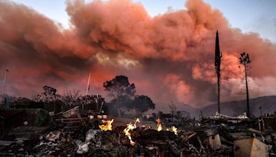
1 day ago · A wind-driven brush fire that began Monday, July 29, south of Highway 371 in Aguanga has forced the evacuation of several homes. Nixon fire grows slightly overnight to 3,750 acres in Aguanga area ...
2 days ago · Nixon Fire. Start Date/Time 2024-07-29. Incident Status Active. Location Tule Valley Road / Richard Nixon Blvd., Aguanga. Type Wildfire. ... Site Map; Glossary of Terms;
2 days ago · - The fire is now 3,700 acres and remains 0% contained. All evacuation orders and warnings will remain in place. UPDATE 7:30 p.m. - The fire has grown to 2,700 acres and remains 0% contained. All evacuation orders and warnings will remain in place. UPDATE 5:00P.M. 07/29: The fire is 1,000 acres and 0% contained. UPDATE: The fire is 131 acres ...
5 hours ago · July 30, 2024 8:32 AM PT. The Nixon fire near Aguanga in southern Riverside County exploded in size after the vegetation fire ignited Monday afternoon, growing to almost 4,000 acres by Tuesday ...
18 hours ago · The Nixon Fire is an active wildfire burning in Riverside county in Southern California. It ignited on July 29, 2024, in the census-designated place of Aguanga in Riverside County. As of July 30, 2024, it has burned 4,500 acres (1,800 hectares) and is 0 percent contained.


