Search results
News about Jasper, wildfire, Canadian Rockies
News about wildfire smoke, air quality, Canada
The BlueSky Canada smoke forecast is our current best estimate of when and where wildfire smoke events may occur over the next two days. The map may not agree exactly with local smoke concentrations and timing, and should be used with care.
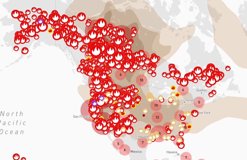
Jun 7, 2023 · Smoke and haze lingers over sections of North America, as polluted air spreads from wildfires. This is the current status of air quality across the United States and Canada.
May 27, 2024 · View current wildland fire conditions on the CWFIS interactive map. The Canadian Wildland Fire Information System (CWFIS) monitors fire conditions and occurrences across Canada. Since 1994, it provides daily national-level wildland fire maps, reports and a wide range of data products and services. This information is used by:
Interactive map. Keyboard users: When the map is in focus, use the arrow keys to pan the map and the plus and minus keys to zoom. The arrow keys will not pan the map when zoomed to the map extent.
The layer, Active Wildfires in Canada, has configurations that are not supported in Map Viewer Classic. To ensure the best experience, open the layer in Map Viewer.
Jun 9, 2023 · Intense wildfires in Canada have sparked pollution alerts across swathes of North America as smoke is blown south along the continent's east coast.
US and Canada fire map and data. NASA | USFS | Fire Information for Resource Management System US/Canada provides near real-time active fire data from MODIS and VIIRS to meet the needs of firefighters, scientists and users interested in monitoring fires with focus on US & Canada.


