Search results
May 3, 2024 · Download the map before you head out—parking is along Forest Road 2620. The Elbo Creek Trail is a steep climb up a forest road under a canopy of Pacific Northwest rainforest endemic to the Olympic National Forest.
- (28)
- Quilcene, Washington, United States
1 day ago · This Washington State nature walk is located at Dosewallips State Park, 306996 US-101, Brinnon, WA 98320, GPS coordinates 47.690518, -122.904955. Dogs are al...
4 days ago · Meeting place and time. Meeting time 8:30 a.m. at the Dosewallips State Park day use area on the east side of Hwy 101 across the Hwy from the state park campground. https://maps.app.goo.gl/kveFaMc9HBkrfTFW7. Leader's notes. This trip is initially open only to Olympic River Rambler students.
3 days ago · Take a left on Hamma Hamma Rd and continue approximately 8 miles until you reach the Lena Lakes/The Brothers trailhead. Leader's notes. This hike is part of the Olympic River Rambler course and is part of the weekend car camp at Dosewallips State Park May 17-19.
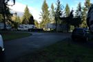
May 11, 2024 · Dosewallips River Road. — Saturday, May. 11, 2024. Did a quick overnight here during a warm mid-May weekend. Parking: I saw ~37 cars at the end of the road when I arrived at around 11:30am on a Saturday. There's plenty of space to park on the side of the road. It's a bit inconvenient that no privy is available, as it's a popular trailhead.
May 11, 2024 · Backpack - Dosewallips River Road Trail. Leisurely beginner-level backpack **WITH DOG(S)** Hike the abandoned road along the beautiful Dosewallips river to the abandoned car campground. See how nature reclaims civilization!
6 days ago · TRAIL: Dosewallips River Road is 6.2 miles of mostly mild-grade, stable footing and wide road, with 3 sections of trails around washouts with steeper grade and rocky footing (all less than 0.3 miles) and one steeper grade ascent from Dosewallips Falls on a wide gravel road (0.2 miles). For those staying 2 nights, on the second day you will have ...