Search results
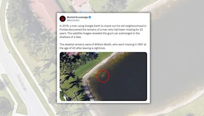
1 day ago · Google Earth is a computer program that renders a 3D representation of Earth based primarily on satellite imagery. The program maps the Earth by superimposing satellite images, aerial photography, and GIS data onto a 3D globe, allowing users to see cities and landscapes from various angles.
5 hours ago · AUSTIN, TX / ACCESSWIRE / April 18, 2024 / Xtra Energy Corp. (OTC PINK:XTPT) is excited to present a Google Earth tour of the recently disclosed results on the interpretation of high-resolution ...
1 day ago · Google has a complicated history with the U.S. military. In 2018, the company walked away from a contract to build AI image-recognition tools for the Pentagon after employees protested the deal .
People also ask
How does Google Earth map the Earth?
How many miles does Google Earth cover?
Does Google Earth have 3D imagery?
How does Google historical imagery work?
5 hours ago · Historic Antimony Mines Featured in the Above Video: Arrance Antimony Prospect - See 4/8/24 Press Release. King Solomon Mine - See 2/21/24 Press Release. Blue Eagle Mine - See 12/21/23 Press ...
4 days ago · Space Dave's Universe Monitor is a free web app for viewing the latest space images and data, including video streams, webcams, satellite images, data visualizations, text reports and more. It's all web-based and accessible from any device, on any screen size from mobile to theater.
2 days ago · In this study, raw images are downloaded from the Google Earth and GF-2 remote sensing satellite. Images of Changping District are downloaded from the GF-2 satellite.
5 days ago · Google satellite imagery has a resolution that ranges from 15 meters to 15 centimeters. Which satellite imagery has the best resolution? Commercial satellite companies such as Maxar Technologies, Planet Labs, and Airbus Defense and Space offer the highest-resolution satellite imagery available to the public.

