Search results
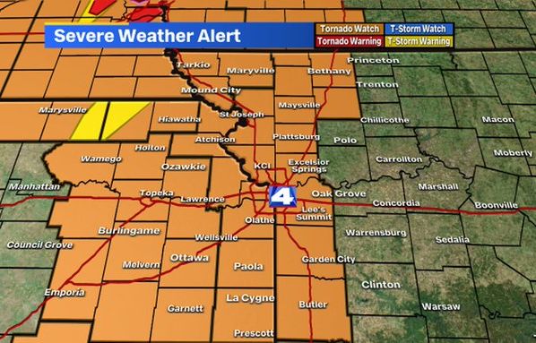
News about Kansas City, severe weather, tornado watch
News about California, power outages, wind advisory
Also in the news
National Weather Maps. Surface Analysis. Highs, lows, fronts, troughs, outflow boundaries, squall lines, drylines for much of North America, the Western Atlantic and Eastern Pacific oceans, and the Gulf of Mexico.
National Weather Service Home page. The starting point for official government weather forecasts, warnings, meteorological products for forecasting the weather, and information about meteorology.
- www.accuweather.com
- › …
- › United States
- › Virginia
- › Boydton
See United States current conditions with our interactive weather map. Providing your local temperature, and the temperatures for the surrounding areas, locally and nationally.
- www.accuweather.com
- › …
- › Washington
- › Quincy
Get the United States weather forecast including weather radar and current conditions in United States across major cities.
United States Weather Conditions See more. Atlanta 75° Austin 78° Boston 43° Brooklyn 52° Chicago 50° Columbus 54° Dallas 74° Denver 63° Houston 76° Los Angeles 60° Manhattan 54° New ...
Sep 8, 2005 · This page contains links to National Oceanic Atmospheric Administration web sites that contain information about weather forecasts. Current Graphical Forecast Maps; Current Outlook Maps; Aviation Weather; Climate; Drought; Fronts/Precipitation Maps; Fire Weather; Hurricanes; Marine; Marine Prediction Forecasts; Climatic Outlooks
National radar mosaic. This view combines radar station products into a single layer called a mosaic and storm based alerts. Weather for a location. This view is similar to a radar application on a phone that provides radar, current weather, alerts and the forecast for a location. Recommended for bookmarks.


