Search results
Learn More. Our programs produce accurate geologic maps and 3-D geologic frameworks that provide critical data for sustaining and improving the quality of life and economic vitality of the Nation.
- Microbiology Program
The Ohio Water Microbiology Laboratory (OWML) provides...
- About Us
Per- and polyfluoroalkyl substances (PFAS) in United States...
- Topographic Maps
The U.S. Geological Survey (USGS) has been the primary...
- All Maps
An official website of the United States government. Here's...
- Volcanic Maps
The USGS Volcano Hazards Program enhances public safety and...
- The National Map Viewer
Use The National Map Viewer to explore base-layer GIS data,...
- Microbiology Program
- KSWB articles via Yahoo
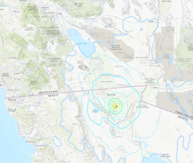
Series of earthquakes near Mexican border rattle San Diego County
Parts of Mexico and San Diego County were rattled by a series of earthquakes near the border Sunday ...
6 hours ago
- New York Times
Map: 6.4-Magnitude Earthquake Strikes off the Coasts of Mexico and Guatemala
Note: Map shows the area with a shake intensity of 4 or greater, which U.S.G.S. defines as “light,” though the earthquake may be felt outsid...
17 hours ago
Interactive database for geologic maps of the United States. The U.S. Geological Survey hosts the National Geologic Map Database (NGMDB). This interactive tool serves as a national archive for high-quality, standardized geologic maps created by the U.S. Geological Survey and state geological surveys. The MapView section of the NGMDB displays ...
In 2015, the USGS unveiled the topoView website, a new way to view their entire digitized collection of over 178,000 maps from 1884 to 2006. The site is an interactive map of the United States that allows users to search or move around the map to find the USGS collection of maps for a specific area.
- 8,670 (2009)
- $1.497 billion (FY2023)
- March 3, 1879; 144 years ago (as Geological Survey)
- United States Department of the Interior
The U.S. Geological Survey's (USGS) Mineral Resources Program's interactive Geologic Map of U.S. States provides a large amount of information on geology, natural resources, and environmental data for every U.S. state, including: Surface and bedrock geology; Mineral resources; Geochemical and geophysical data; Water monitoring sites
TopoView lets users access the many and varied U.S. Geological Survey topographic maps. It's particularly useful for historical purposes because the names and extents of many natural and cultural features have changed over time. In this detailed guide, we’ll take a tour of the various components of topoView and show you what each can do.
People also ask
Where can I find USGS geologic maps?
What is a geologic map?
How many USGS Historical maps are there?
How many USGS topographic maps are there?

