Search results
Jun 29, 2024 · The purple circle indicates the extent of hurricane-force winds (at least 74 mph), according to the National Hurricane Center. Current sustained winds at reporting stations are also plotted.
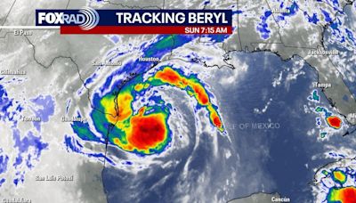
1 day ago · Live tracking map, satellite images and forecasts of Hurricane Beryl 2024 over the Yucatán Peninsula. Current wind speed 85mph. Max 165mph. Dangerous winds, storm surge, and heavy rainfall will continue over portions of the Yucatán Peninsula within the warning areas today (5 July).
3 days ago · One-stop event page for #Beryl Posted July 5, 2024 NOAA's National Weather Service wants you to have the latest information on Hurricane Beryl to keep you informed and safe. Here is a compilation of information that you can use before, during, and after the storm to have the most current forecasted weather conditions for your area, an
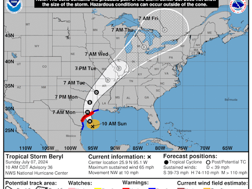
2 days ago · Hurricane Beryl path tracker. This forecast track shows the most likely path of the center of the storm. It does not illustrate the full width of the storm or its impacts, and the center of the ...
1 day ago · Beryl was a tropical storm in the Gulf of Mexico early Sunday Central time, the National Hurricane Center said in its latest advisory. The tropical storm had sustained wind speeds of 60 miles...
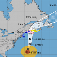
About this product: This graphic shows an approximate representation of coastal areas under a hurricane warning (red), hurricane watch (pink), tropical storm warning (blue) and tropical storm watch (yellow). The orange circle indicates the current position of the center of the tropical cyclone.
3 days ago · Track the storm: Hurricane Beryl is now a Category 2 storm as it heads toward Mexico’s Yucatan Peninsula after hammering several Caribbean islands, including the Cayman Islands and Jamaica,...
