Search results
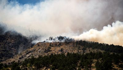
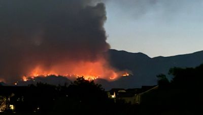
2 days ago · Update 6 p.m. July 29 -- Latest flight information shows Alexander Mountain Fire has grown to 864 acres. Alexander Mountain Fire was first reported shortly after 11 a.m. July 29, 2024. The fire is located north of Highway 34, west of Loveland. The fire has grown rapidly and resulted in multiple evacuation orders from the Larimer County Sheriff ...
1 day ago · Settings. Fast style plays animations immediately. Smooth style preloads imagery for a better appearance. Satellite images, weather and heat maps of Alexander Mountain Fire, Larimer County, Colorado, United States. Burn size is 1,825 acres. 0% contained.
1 day ago · Alexander Mountain Fire spreads to nearly 1,000 acres with 0% containment: See map. A fast-moving wildfire in north central Colorado has spread to nearly 1,000 acres, forcing mandatory evacuations ...
1 day ago · July 30, 2024 at 10:21 a.m. EDT. First sighted Monday morning, the Alexander Mountain Fire has burned more than 800 acres just west of Loveland and Fort Collins, approximately 40 miles north of ...
2 days ago · Alexander Mountain - Wildfire (Larimer County, CO) Larimer: CO: July 29, 2024, 11 a.m. ... reaching as far as central Idaho. As of this morning, this fire is said to be approximately 12% contained and has burned approximately 370,000 acres since it began on 7/24/2024. ... this interactive map is your guide to impacts and damage reports coming ...
2 days ago · County Road 43. Current Evacuation Shelters: Foundations Church at 1380 N Denver Ave, Loveland, 80537. Estes Park Community Center at 1125 Rooftop Way, Estes Park, 80517. Animal Evacuation Information: Large animals can be evacuated to The Ranch Events Center & Complex at 5400 Arena Cir, Loveland, 80538. Current Evacuation Map / Road Closures.
Alexander Mountain Fire was first reported shortly after 11 a.m. July 29, 2024. The fire is located north of Highway 34, west of Loveland. The fire has grown rapidly and resulted in multiple evacuation orders from the Larimer County Sheriff's Office. As of 3 p.m. July 29, the fire is burning almost entirely on National Forest lands.
2 days ago · The Alexander Mountain Fire burning west of Loveland has grown to an estimated 950 acres with no containment as of 7:45 p.m ... in the map below. Major road closures are also displayed on the map. ...
1 day ago · The Alexander Mountain fire was reported through a 911 call Monday morning, and it quickly grew to 247 acres before 1 p.m. ... A full map of mandatory evacuation zones and areas that should be ...
1 day ago · The Alexander Mountain Fire is burning in the Roosevelt National Forest west of Loveland and is almost entirely on National Forest lands at this time. ... To access the evacuation zone map,go here. Drake to Dam Store along Highway 34 including Storm Mountain and Palisade Mountain; Area of Waltonia Road, Eden Valley to Sunrise Ranch, and Sylvan ...


