Search results
Brazil national football team
Other games
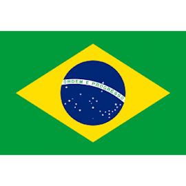
Brazil, officially the Federative Republic of Brazil, is the largest and easternmost country in South America and in Latin America. Brazil is the world's fifth-largest country by area and the seventh most populous. Its capital is Brasília, and its most populous city is São Paulo.
- Overview
- The land
- Geographic regions
- Relief
Brazil, country of South America that occupies half the continent’s landmass. It is the fifth largest country in the world, exceeded in size only by Russia, Canada, China, and the United States, though its area is greater than that of the 48 conterminous U.S. states. Brazil faces the Atlantic Ocean along 4,600 miles (7,400 km) of coastline and shares more than 9,750 miles (15,700 km) of inland borders with every South American country except Chile and Ecuador—specifically, Uruguay to the south; Argentina, Paraguay, and Bolivia to the southwest; Peru to the west; Colombia to the northwest; and Venezuela, Guyana, Suriname, and French Guiana to the north. Brazil stretches roughly 2,700 miles (4,350 km) from north to south and from east to west to form a vast irregular triangle that encompasses a wide range of tropical and subtropical landscapes, including wetlands, savannas, plateaus, and low mountains. Brazil contains most of the Amazon River basin, which has the world’s largest river system and the world’s most-extensive virgin rainforest. The country contains no desert, high-mountain, or arctic environments.
Brazil is the fifth most-populous country on Earth and accounts for one-third of Latin America’s population. Most of the inhabitants of Brazil are concentrated along the eastern seaboard, although its capital, Brasília, is located far inland and increasing numbers of migrants are moving to the interior. Rio de Janeiro, in the eyes of many of the world, continues to be the preeminent icon of Brazil. The nation’s burgeoning cities, huge hydroelectric and industrial complexes, mines, and fertile farmlands make it one of the world’s major economies. However, Brazil struggles with extreme social inequalities, environmental degradation, intermittent financial crises, and a sometimes deadlocked political system.
The Brazilian landscape is immense and complex, with interspersed rivers, wetlands, mountains, and plateaus adjoining other major features and traversing the boundaries of states and regions.
Why emerging markets might be worth owning in a diversified portfolio
The Brazilian government has grouped the country’s states into five large geographic and statistical units called the Major Regions (Grandes Regiões): North (Norte), Northeast (Nordeste), Central-West (Centro-Oeste), Southeast (Sudeste), and South (Sul). The tropical North—comprising the states of Acre, Rondônia, Amazonas, Pará, Tocantins, Roraima, and Amapá—covers more than two-fifths of Brazilian territory and includes the largest portion of Amazon rainforest and parts of the Guiana and Brazilian highlands; however, the region accounts for a limited proportion of the nation’s population and economic output.
The Northeast, which experiences some of the nation’s driest and hottest conditions, has nearly one-fifth of Brazil’s land area and more than one-fourth of the population. It contains the states of Maranhão, Piauí, Ceará, Rio Grande do Norte, Paraíba, Alagoas, Sergipe, Bahia, and Pernambuco, the latter including the island of Fernando de Noronha, some 225 miles (360 km) off the Atlantic coast. The region’s oldest cities date from the 16th century, when the Portuguese first established sugarcane plantations there. The Northeast accounts for one-fifth of the nation’s agricultural production, but the industrial and service sectors lag far behind those of the Southeast and South, and the unemployment rate remains high.
Special offer for students! Check out our special academic rate and excel this spring semester!
Learn More
The Southeast covers only one-tenth of Brazil’s territory but has two-fifths of its population and the greatest concentration of industrial and agricultural production in the nation. The region includes São Paulo state, which is the nation’s economic and demographic heartland, landlocked Minas Gerais, whose very name (meaning “Extensive Mines”) testifies to great mineral wealth, and the populous coastal states of Espírito Santo and Rio de Janeiro. The city of Rio de Janeiro, the national capital from 1763 to 1960, remains Brazil’s main cultural and tourist centre.
The South, which stretches below the Tropic of Capricorn, includes the states of Paraná, Santa Catarina, and Rio Grande do Sul. It occupies an area nearly as large as the isle of Britain but is the smallest of Brazil’s regions. Its diversified economy includes strong manufacturing, agriculture, and service sectors. The South has about one-seventh of the nation’s population, including many people of European ancestry, particularly from Germany and Italy. The South’s tourist trade partly depends on the spectacular Iguaçu Falls, at the Argentine border.
Brazil is a predominantly tropical country famous for its extensive Amazon lowlands; however, highlands cover most of the national territory. Brazil’s physical features can be grouped into five main physiographic divisions: the Guiana Highlands in the North, the Amazon lowlands, the Pantanal in the Central-West, the Brazilian Highlands (including t...
Brazil, officially Federative Republic of Brazil, Country, east-central South America. Area: 3,282,907 sq mi (8,502,728 sq km). Population: (2024 est.) 205,223,000. Capital: Brasília. Most Brazilians are of European or mixed (Indian-European, European-African) ancestry.
Apr 9, 2024 · A comprehensive overview of Brazil's geography, history, politics, economy, and society. Learn about its location, climate, natural resources, land use, major rivers, and more.
Jun 27, 2023 · Learn about the geography, history, and culture of Brazil with maps and facts. Explore the outline, states, regions, cities, and physical features of the largest country in South America. See where Brazil is located, its bordering countries, and its major cities.
Brazil, officially the Federative Republic of Brazil, is the largest and easternmost country in South America and in Latin America. Brazil is the world's fifth-largest country by area and the seventh most populous. Its capital is Brasília, and its most populous city is São Paulo.
Learn about Brazil, the largest country in South America and the fifth largest in the world. Discover its diverse geography, culture, wildlife, and history. Find out how Brazil is famous for soccer, forests, and rain forests.


")


