Search results
Washington Republicans wrestle with realities of a redrawn political map
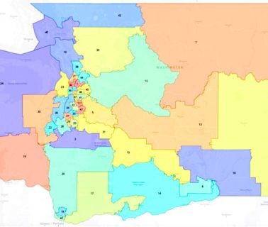
In a committee work session, three GOP senators registered disbelief that the redrawn 14th Legislati...
Washington State Standard via Yahoo
17 hours ago
NONFICTION: English Station - Yale Daily News
English Station was built on Ball Island between 1924 and 1929 and operational until around 1991, burning coal and oil. It was owned and ope...
Yale Daily News
35 minutes ago
Washington State Map. General Map of the State of Washington, United States. The detailed map shows the US state of State of Washington with boundaries, the location of the state capital Olympia, major cities and populated places, rivers and lakes, interstate highways, principal highways, railroads and major airports.
This map shows many of Washington's important cities and most important roads. Important north - south routes include: Interstate 5 and Interstate 405. Important east - west routes include: Interstate 82 and Interstate 90. We also have a more detailed Map of Washington Cities .
Washington Cities: Cities with populations over 10,000 include: Aberdeen, Anacortes, Auburn, Bellevue, Bellingham, Bremerton, Burien, Camas, Centralia, Kennewick, Des Moines, Edmonds, Ellensburg, Everett, Federal Way, Issaquah, Kelso, Kent, Lacey, Lakewood, Longview, Marysville, Moses Lake, Mount Vernon, Mountlake Terrace, Mukilteo, Oak Harbor ...
Jan 7, 2024 · GISGeography Last Updated: January 7, 2024. Download. About the map. This Washington map contains cities, roads, rivers, and lakes. For example, Seattle, Spokane, and Tacoma are major cities shown in this map of Washington. But the capital is not any of these more populated cities, it’s Olympia. Washington is the “Evergreen State “.
Apr 17, 2024 · map of Washington. Tour Washington state, birthplace of guitarist Jimi Hendrix, Microsoft, and Nobel Prize-winner Linda Buck. Learn more about the state of Washington—the only state named after a U.S. president—and its geography, people, economy, and history. (more) See all videos for this article.
Jan 7, 2024 · This Washington State Map shows major landmarks in Washington. For example, the map features national parks, wildlife refuges, national forests, and federal lands in Washington. Washington is a state full of history and culture, and there are many places to visit and explore.
The detailed, scrollable road map displays Washington counties, cities, and towns as well as Interstate, U.S., and Washington state highways. The pannable, scalable Washington street map can be zoomed in to show local streets and detailed imagery.

