Search results
Aug 8, 2024 · This graphic shows an approximate representation of coastal areas under a hurricane warning (red), hurricane watch (pink), tropical storm warning (blue) and tropical storm watch (yellow). The orange circle indicates the current position of the center of the tropical cyclone.
- Hurricane DEBBY Imagery
Hurricane DEBBY Aerial Imagery Response. About. View tips...
- NH C
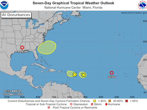
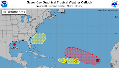
Satellite | Buoys | Grids | Storm Archive. ...FRANCINE...
- Hurricane DEBBY Imagery
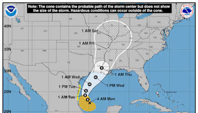
19 hours ago · Satellite | Buoys | Grids | Storm Archive. ...FRANCINE QUICKLY BECOMING BETTER ORGANIZED... ... STORM SURGE AND HURRICANE WARNINGS ISSUED FOR PARTS OF THE LOUISIANA COAST... 4:00 PM CDT Mon Sep 9. Location: 24.0°N 96.0°W. Moving: NNW at 7 mph.
These wind speed probability graphics are based on the official National Hurricane Center (NHC) track, intensity, and wind radii forecasts, and on NHC forecast error statistics for those forecast variables during recent years.
Aug 3, 2024 · Here is a compilation of information that you can use before, during, and after the storm to have the most current forecasted weather conditions for your area, evacuation and shelter information, and available resources to help keep you safe.
Aug 6, 2024 · Tropical Storm Debby has already lashed Florida and is forecast to slow to a crawl near the Southeast coast over the coming days as a major rainfall flood threat. F or the latest collection of...
Hurricane DEBBY Aerial Imagery Response. About. View tips for accessing imagery through NOAA's Big Data Program. This imagery was acquired by the NOAA Remote Sensing Division to support NOAA homeland security and emergency response requirements.
Aug 3, 2024 · Debby was a tropical depression over North Carolina Thursday afternoon Eastern time, the National Hurricane Center said in its latest advisory.
